Hello from Helsinki, Finland.
This is a quick update regarding the cruise we were on. It was the MSC Preziosa and we departed from Hamburg, Germany and travelled up the coast of Norway, to Svalbard, and then back down the coast of Norway returning to Hamburg. We left Hamburg and flew to Helsinki the same day we arrived.
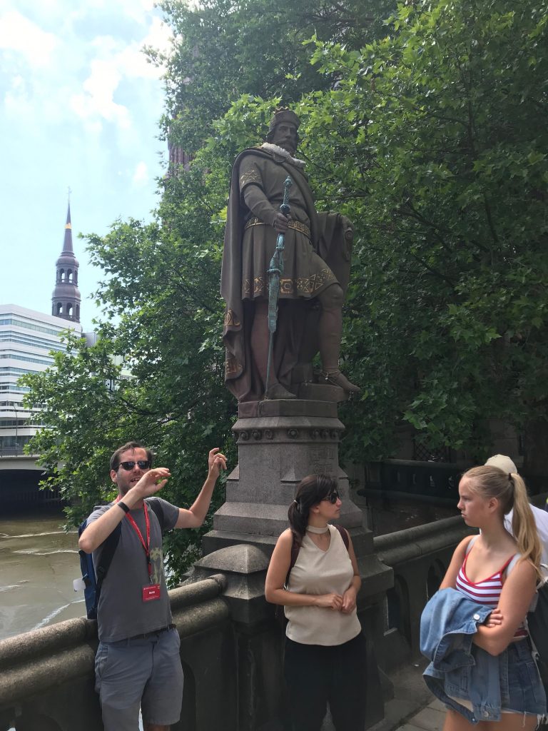
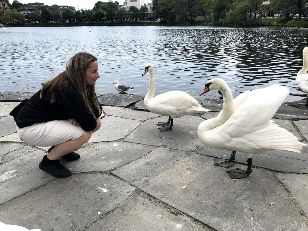
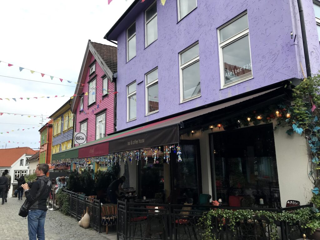
A quick note about Hamburg as we were there for about 24 hours. We stayed at a hotel/hostel kind of place that we believed to be near the cruise terminal. We bought a 24 hour pass for the metro system. We did a free walking tour that showed us the highlights of the city. We learned that Hamburg is a very rich city (more than 60 millionaires live here and several billionaires); swans are protected (they create heated ponds for them in the winter); and we learned about the Hanseatic League. Our day pass also allowed us to get to the cruise terminal where our boat was leaving from (not where we thought it was).
We boarded in Hamburg and immediately realized that we were the minority on the ship. It was overwhelmingly European, with Germans and Italians being the majority. Every announcement was in five languages: English, German, Italian, Spanish, and French. It was particularly impressive how many of the crew spoke many of these languages. That said, I found it frustrating that every announcement went on and on and on getting through every language.
There were several things about MSC that we did not really like. Firstly, and perhaps because it was a European company, but smoking was abundant. You could not find a deck were there was a smoking section and frankly they were often in the best area of the deck. That was very difficult to deal with for us. Also, in the restaurant, they would not give you tap water. They sold bottled water for about 2 euros for 500 ml and 3 euros for 1 l. All of their promotional items talk about their sustainable practices. However, they went through so many plastic bottles… mostly Nestle… that it is hard to say they are sustainable. Finally, I would say the food was mediocre at best. Enough about that… on to the port stops.
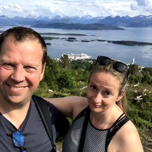
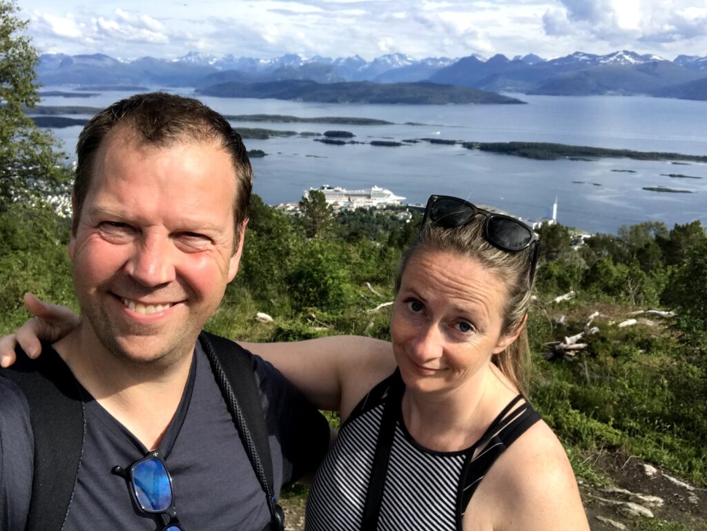
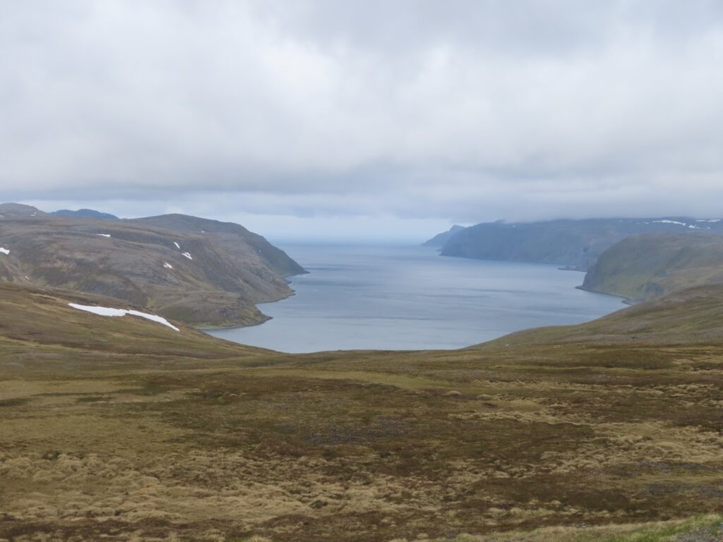
Our first stop was in Molde, Norway (62°45′23″N 07°14′19″E; population 27,000). One of the best things about this port stop was navigating in and out through the fjords leading into Molde. We wandered around the city for a while. There is a hike up to a scenic viewpoint called Varden (407m above sea level) which has amazing views of the city and the archipelago. I think we took a very roundabout way to get there and so it took longer than it could have. At the top, we took a few minutes to find a geocache as well. The other popular thing to do in Molde is to drive the Atlantic Road which crosses a bridge that is supposed to be amazing. We ran out of time to do that though.
While heading towards Tromsø there was a bit of excitement at about 11pm. There was a medical emergency and a helicopter came to take them to medical help. The ship had to turn around for about an hour and a half to meet the helicopter. The helicopter hovered alongside the ship, two people were lowered onto the ship. They took up the ill individual in a basket. We caught it on video… at least part of it.
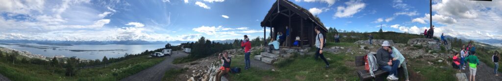
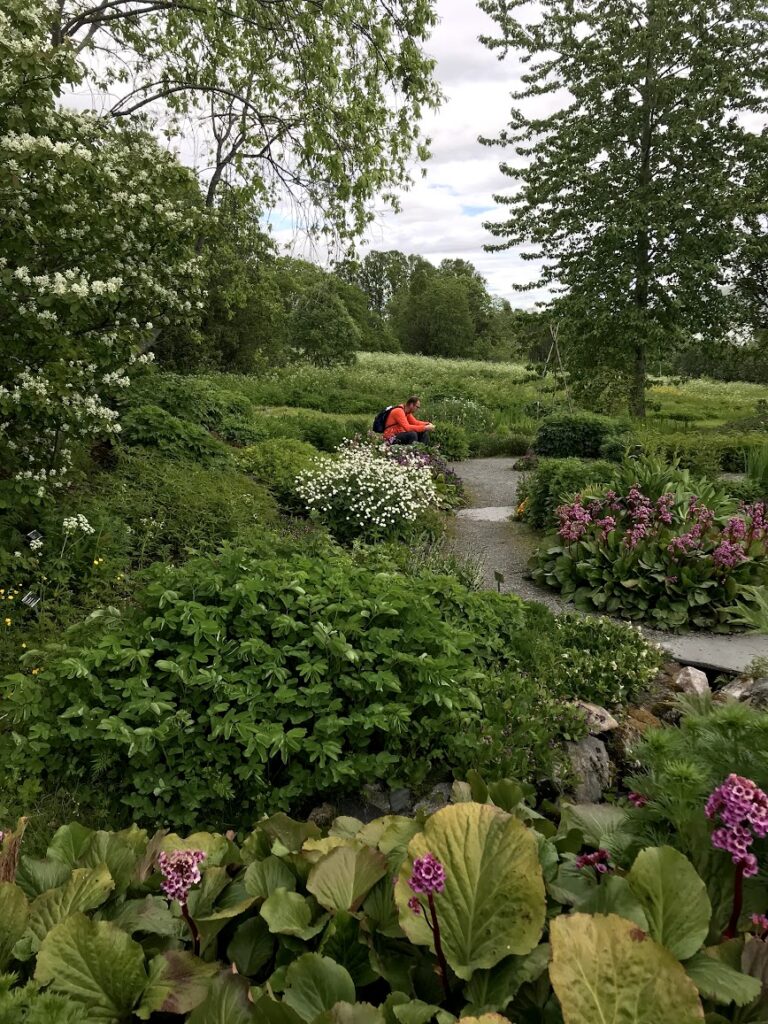
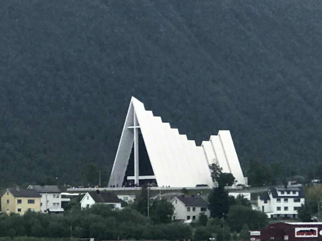
Our next stop was in Tromsø, Norway (69°40′58″N 18°56′34″E; population 76,000). In Tromsø, we wandered to the botanical gardens which was pretty impressive for so far north. It was attached to the University (UIT). Aurora College has worked with this university in the past (student transfers) so I wanted to wander around the campus. We walked from the university along a ski trail and down through the city centre. It was June 21st (longest day of the year) and the city was gearing up for a bit of a festival including a midnight marathon. Next, we crossed the bridge towards the Tromsø Cathedral. We started the climb towards Fløya. There is a funicular that goes to the top but it is quite expensive (as is all of Norway). There are Sherpa steps to the top but by the time we got to the base we had already walked 16km. We (or maybe I) decided that with the 7km walk back to the ship that was enough for the day.

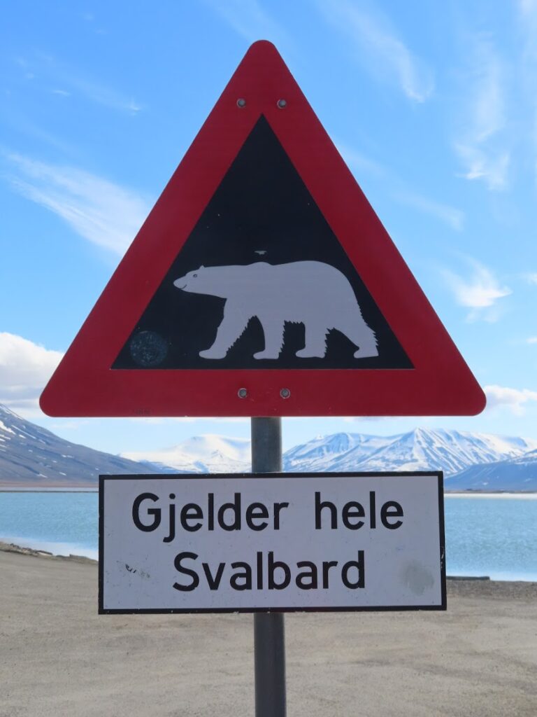
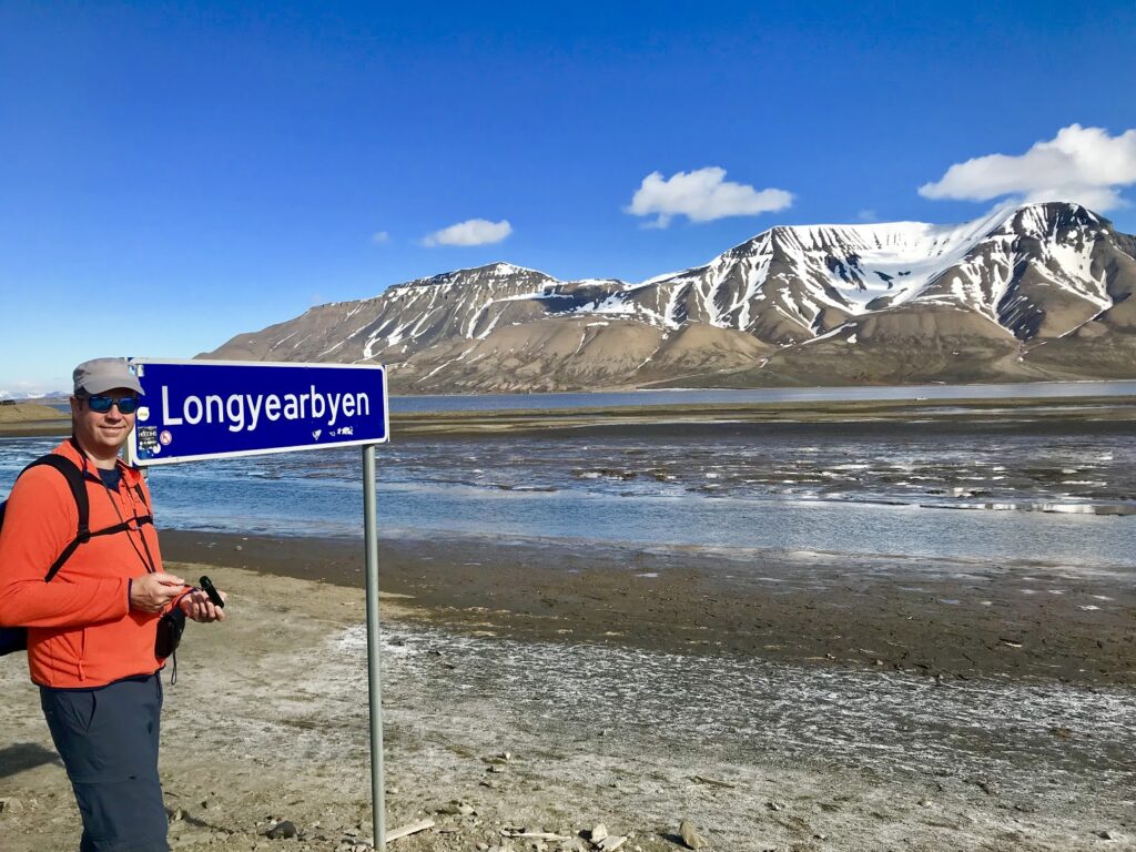
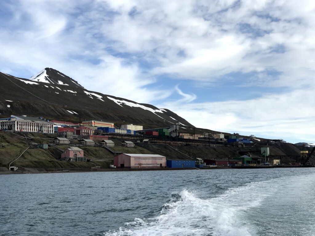
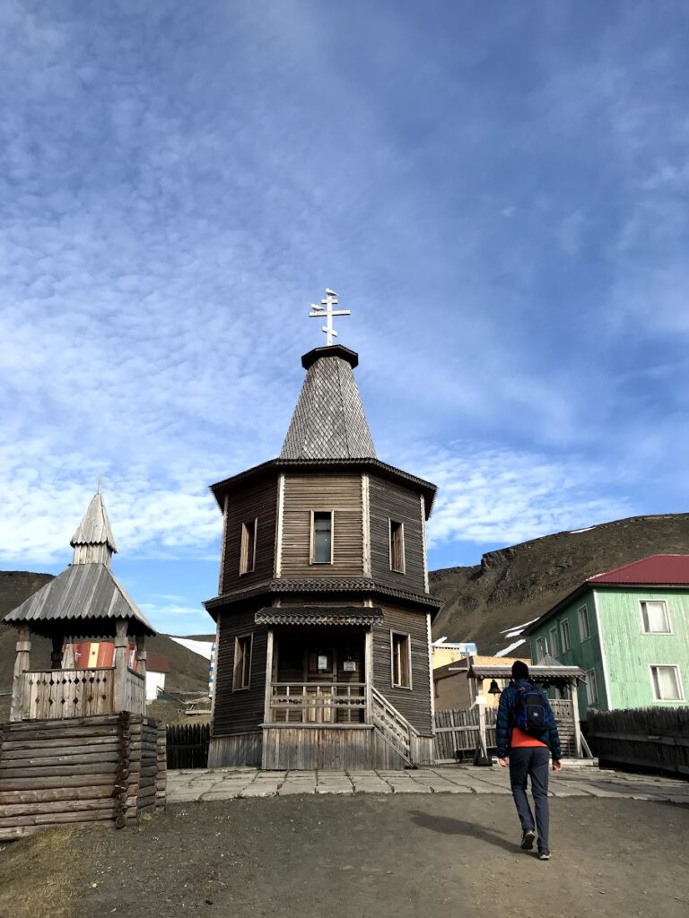
The main reason for selecting this cruise was the stop in Svalbard. We arrived in Longyearbyen (78°13′N 15°38′E; population 2100) at about 8am. We had booked a tour to Barentsburg for about noon. Before this, we wandered around the town. We walked past the dog teams and to a sign warning you about polar bears. This is essentially the limit for how far you are safely supposed to go without someone with a gun. Along the way, we grabbed our most northerly geocache. We had to rush back for our tour.
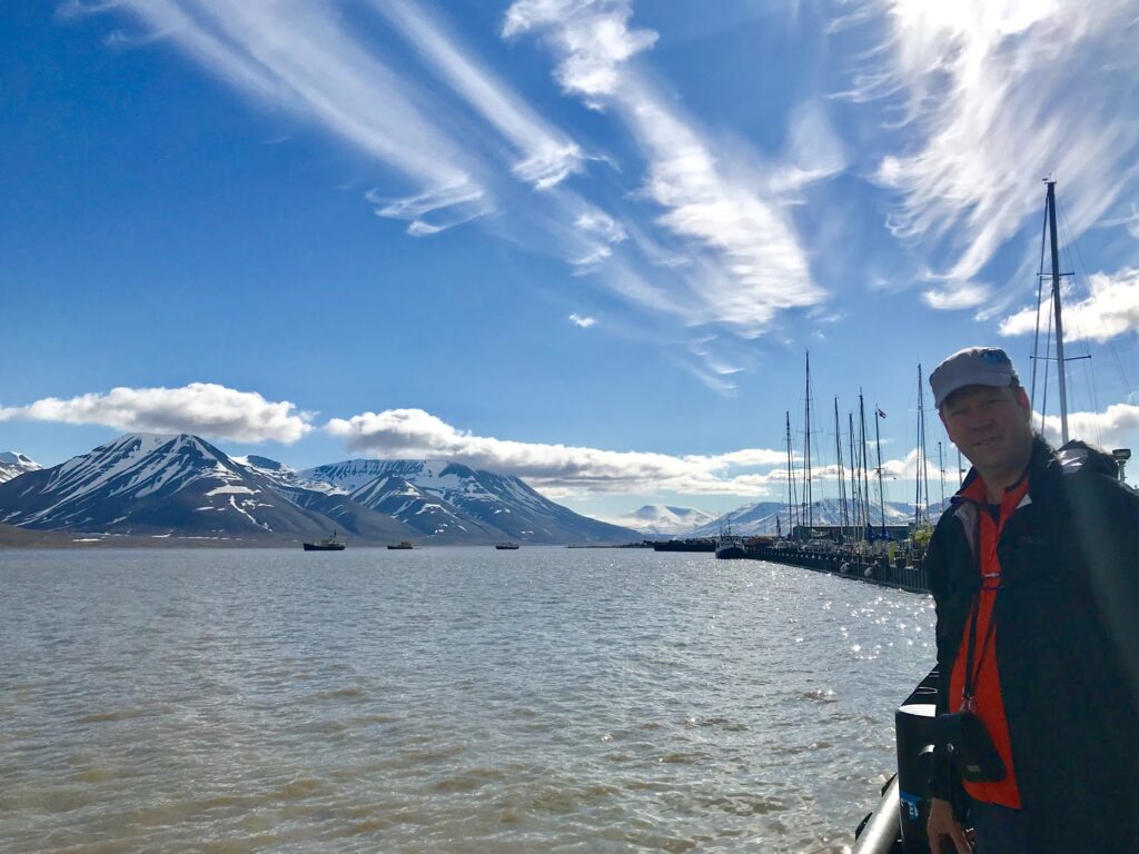
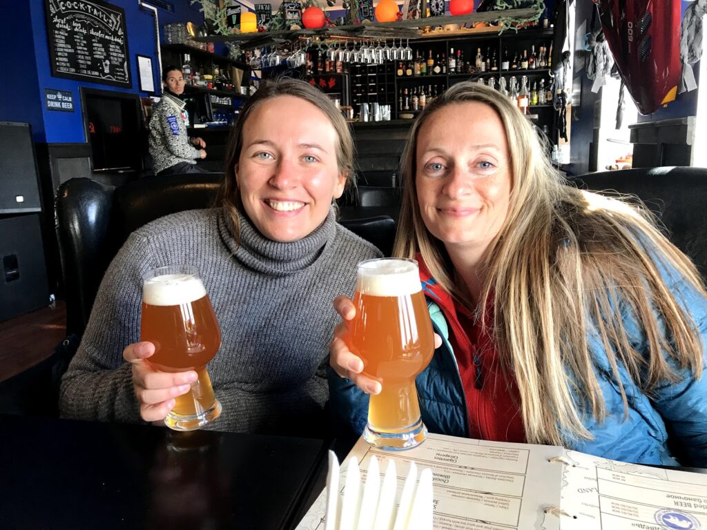
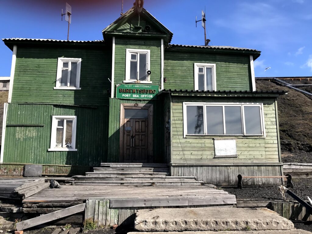
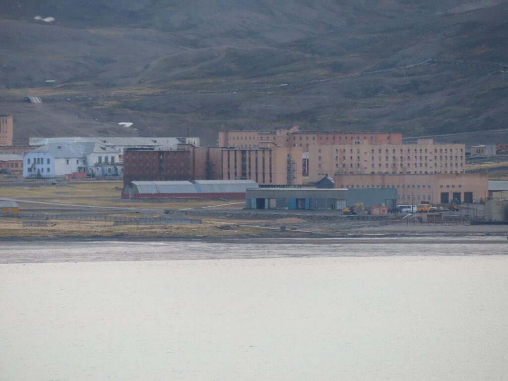
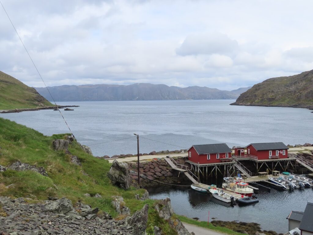
While Svalbard is part of Norway, there is an agreement that every country can conduct research, business, etc. there without having to seek permission. Barentsburg is the last operating Russian coal mining town. The boat ride was about 1.5 hours each way. It was an express trip so there was no stopping and no commentary… just a fast ride. There was a tour by a Russian girl that lasted about 45 minutes. We then had about 2 hours to explore on our own. We spent most of that in a bar with our new Finnish friend, Veera.
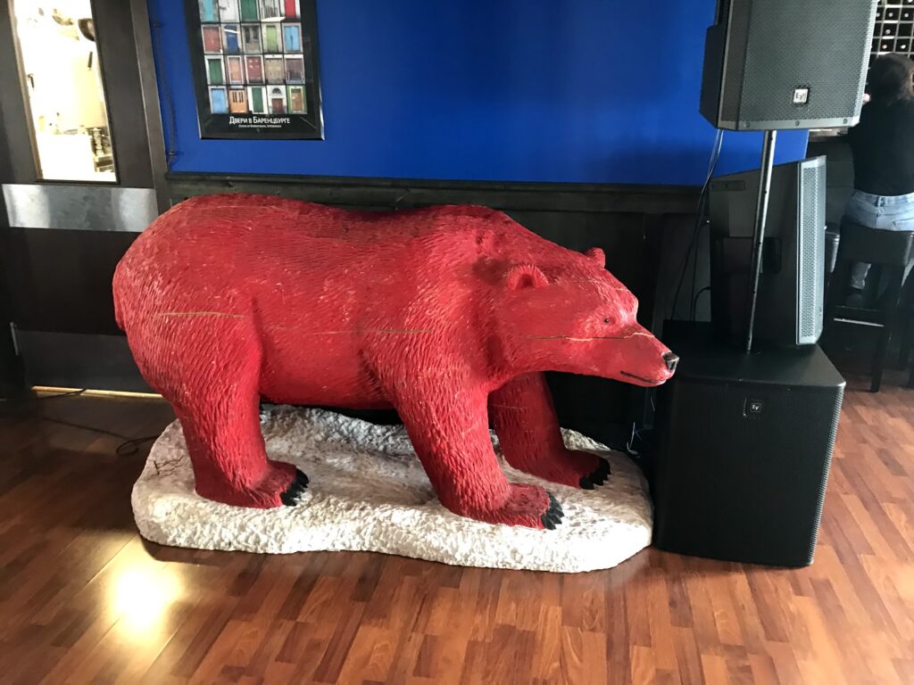
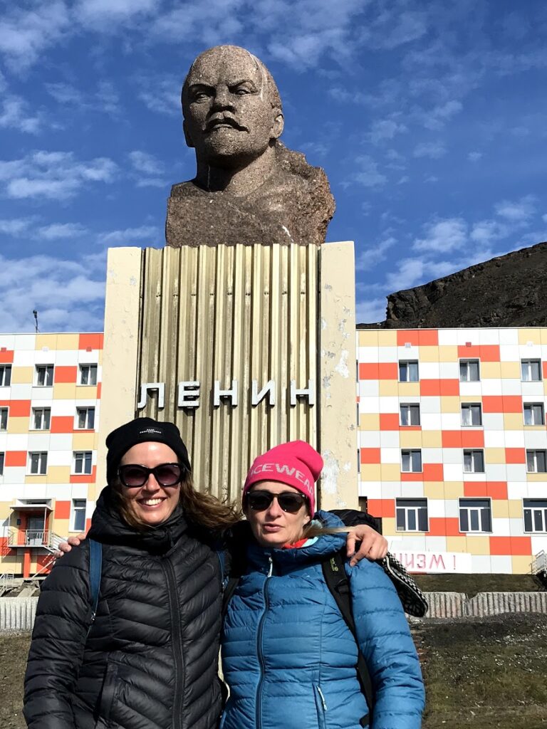
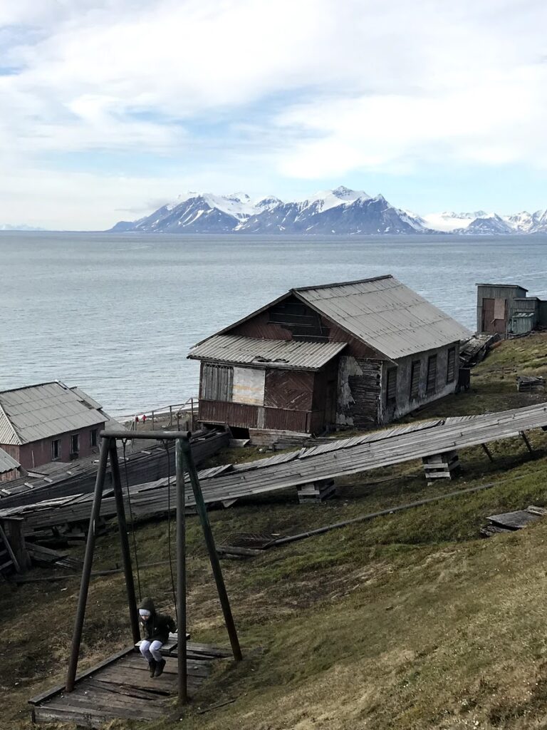
Most of the workers in Barentsburg (78°04′0″N 14°13′0″E; population 471) are from the Ukraine while most of the managers are Russian. Workers sign a two year contract and cannot leave at all for two years. They cannot even go to Longyearbyen during that two years. In their very small store, prices are in both Russian Rubles and Norwegian Kroners. Food shipments only come in every two months. The buildings are a mix of looking dilapidated and new. The photos are the best way to show you what we saw. There was not a lot of signs of life… but it was Sunday.

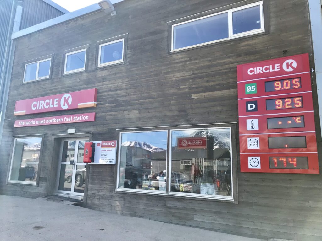
Back in Longyearbyen, we discovered almost everything was closed. Being Sunday we now realized that everything closed about 4pm. There were only two things open… the museum and the brewery. They claim to be the most northern brewery in the world. It is hard to know for sure but they claim to have the most northern of lots of things. It was a nice beer but very expensive (about twice the cost of the one in Barentsburg).
When we left Svalbard, the captain decided to cruise into a fjord where there is an abandoned (or almost abandoned) Russian mining town called Pyramiden (78°39′22″N 16°19′30″E; population 0). I had wanted to see it when I was researching tours. I guess I got to see it from the ship. There is a hotel there that they operate during tourist season only. As it turns out this was our most northerly position on this cruise. And in fact, the most north that I have ever been. I lived in Igloolik, Nunavut (69°22′34″N 081°47′58″W) which until this was the most north I had ever been.
Back in continental Norway, our next stop was Honningsvåg (70°58′43″N 25°58′36″E ; population 2500). Honningsvåg is an island at the very top of Norway. The biggest attraction is Nordkapp (North Cape). This is a tourist attraction as the most northern point in Europe. Two points of order about that however: 1) it would seem to me that Svalbard has a better claim to that; and 2) there is actually a point close by that is actually further north. Most people buy a pass on a bus including admission to Nordkapp for about $75 CAD.
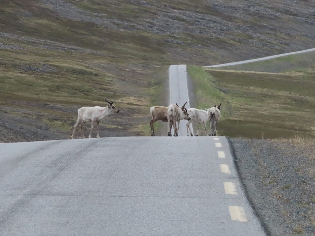
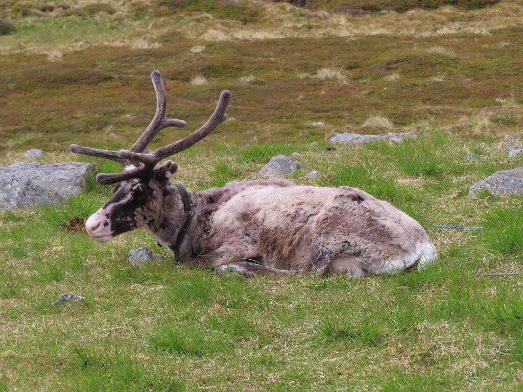
We decided to look into renting a car and doing it on our own. We ended up renting a van with a Swiss family and going to do a hike to the “real” north cape. It is about a two hour hike one way. We drove there in about a half hour. We got about ten minutes into the hike and a fog so thick set in that it was not really wise for us to continue. The trail was not really well marked and if the fog was that thick when we arrived we would not really see anything. So, instead we drove around the whole island exploring little fishing villages; stopping to take scenic photos; and photographing lots of reindeer. It turned out to be quite a nice day getting to know them while exploring the island. Before getting back on the ship, we got another… you guessed it… geocache. It was a quick find close to the ship. We returned to the ship, ate dinner, and then went back ashore for a bit more hiking and exploring. We did not leave until about 2am.
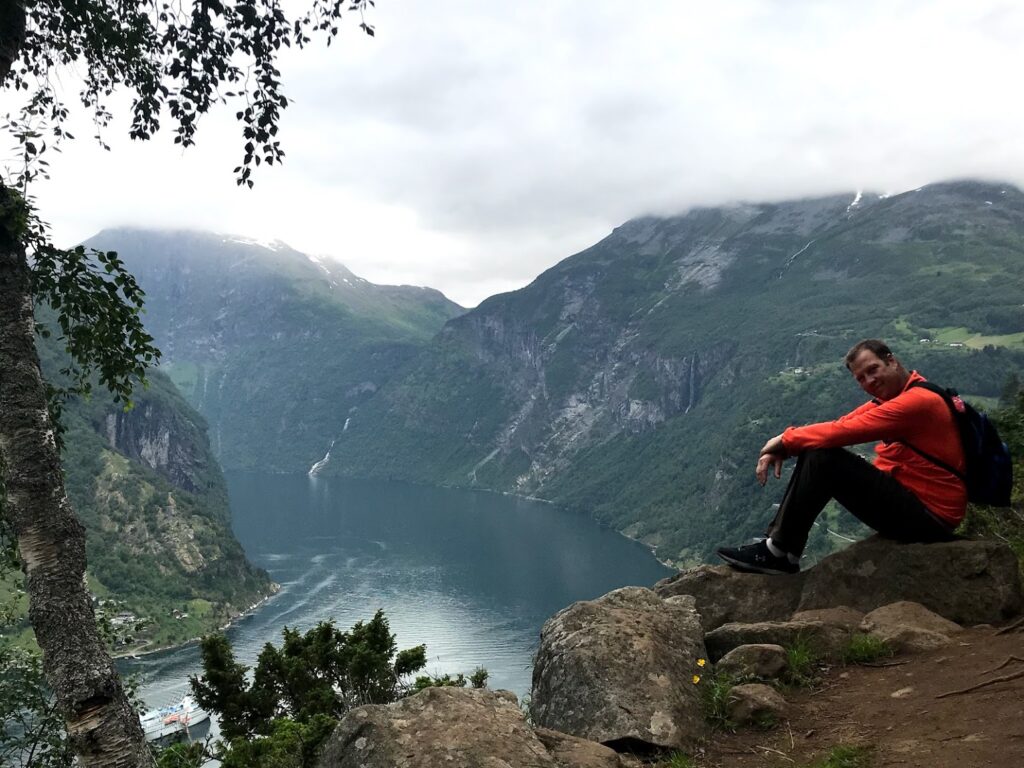
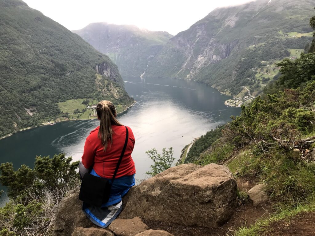
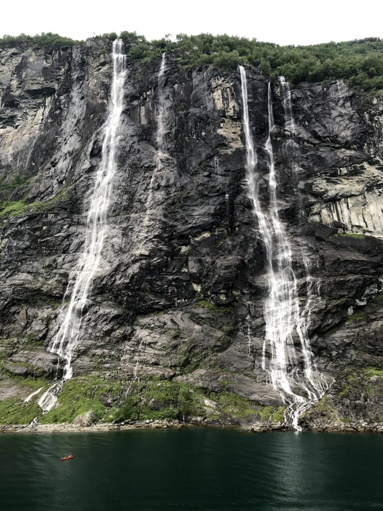
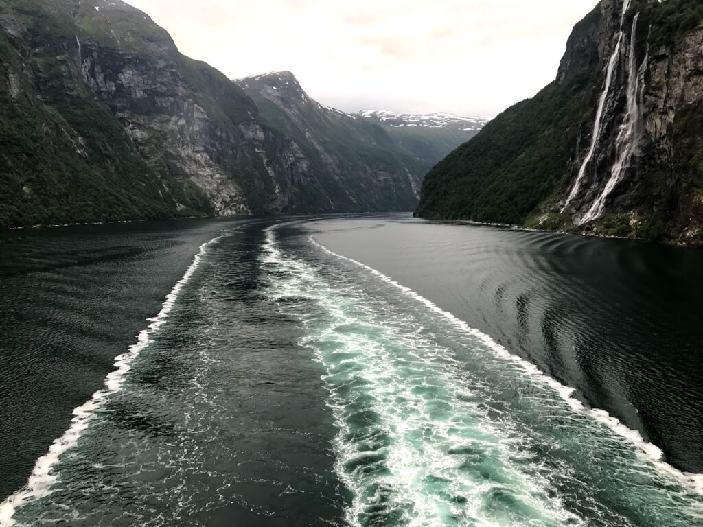
Geiranger (62°05′58″N 07°12′23″E; population 250) was our next port stop albeit a short one. Frankly, the sight to see here is actually the Geirangerfjord. The fjord is a narrow channel about 22km in length between Geiranger and Hellesylt. We got up at 5am to watch the way into Geiranger and then saw it again at the end of the day as we left. There are pictures below of the Seven Sisters (a big waterfall) and other sheer faced cliffs that line both sides. In Geiranger, Nic and I did a hike up to a scenic viewpoint that we had learned about in the tourist information office. The view was spectacular and for some reason we seemed to be only ones up there. Great new Facebook profile pics.
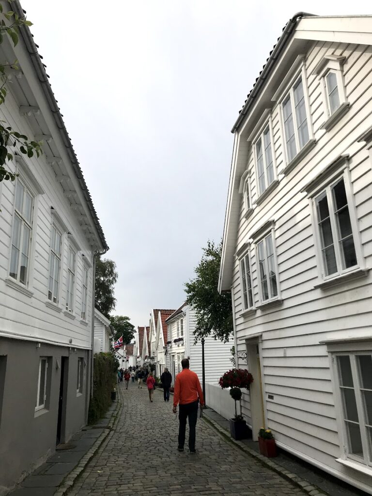
The last stop was Stavanger (58°57′48″N 05°43′08″E; population 237,000). Stavanger is the third largest city in Norway after Oslo and Bergen. It is the oil capital of Norway. The city population boomed in the late 20th century with the explosion of the offshore oil industry in Norway. In fact, the Norwegian economy itself has grown tremendously due to becoming an oil producing country. We had considered a hike to a place called Preikestolen (Pulpit Rock). However, since the time the ship was in Stavanger was so short, it would have been very rushed. The ship offered an excursion to do it but it was very expensive. I think I can envision a return visit someday to do some of the cool hikes like Pulpit Rock, Kjerag and Trolltunga.
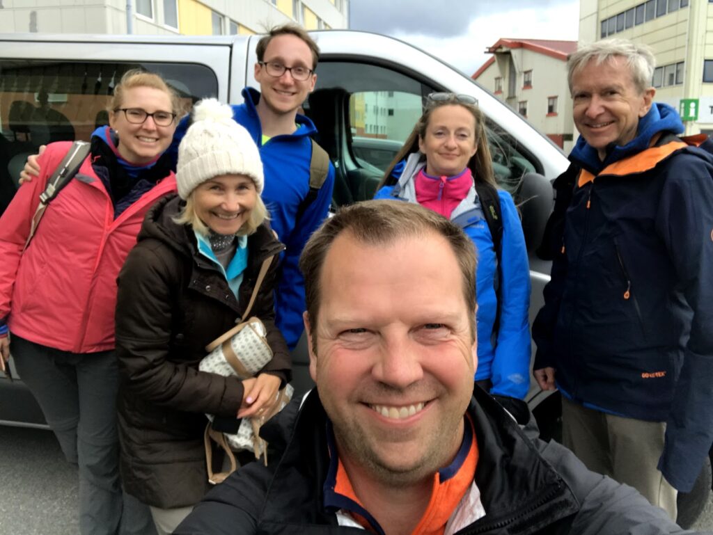
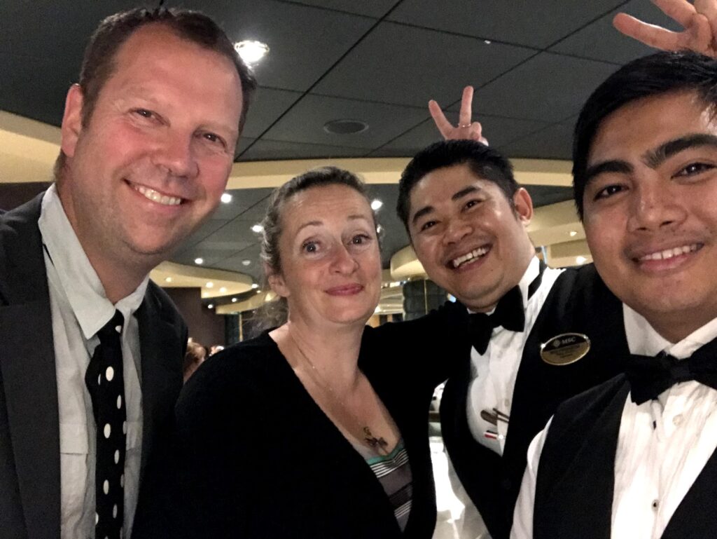
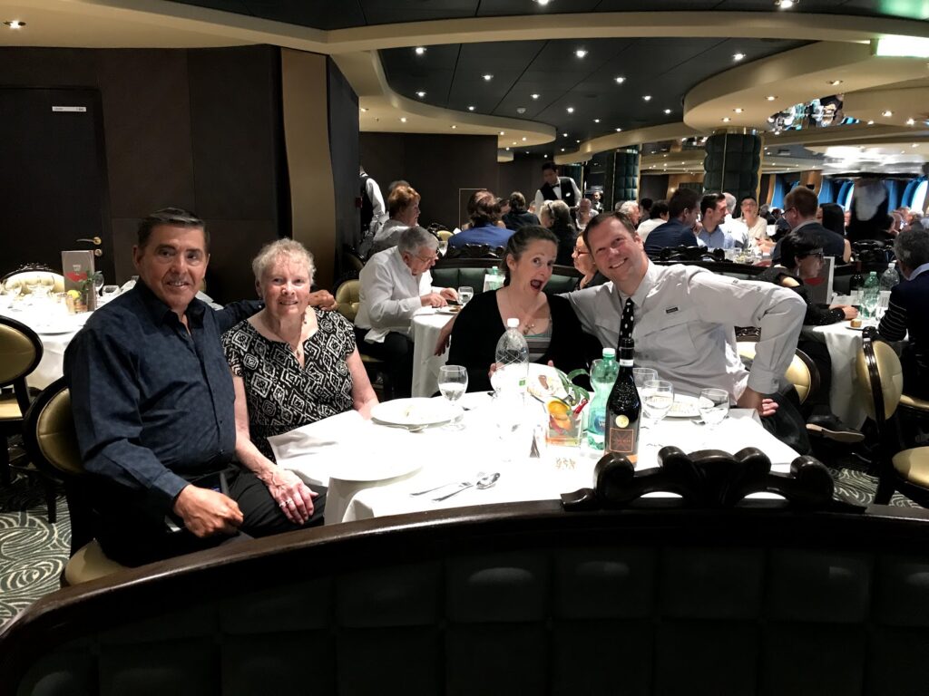
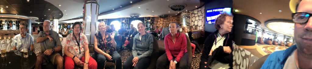
We met some good folks on the cruise. We played trivia once or twice each sea day. The same crew showed up most of the time. This was our way to get to speak with other English speaking folks. There is a picture of the group below. We went to some of the shows, generally enjoying the ones with acrobatics the best. Our two waiters were very attentive to us. And we ate many meals with the only other Canadians we met on the ship.
As I mentioned, we are now in Helsinki. Tomorrow we are heading for 71 hours and 59 minutes in St. Petersburg, Russia. It is the only way to do it visa free (at least that we found). Nic has bought tickets to two ballets and we will explore the city and visit the Hermitage. We will return to Tallinn, Estonia on July 8th (my birthday). My next post will be about Helsinki and St. Petersburg.